
aerial data & technology
Professional Mapping & inspections
dependable results
Real Data. Real Decisions. Cadence Aerial.
Our work
Based in the Austin, Texas metropolitan area, Cadence Aerial provides aerial inspection, LiDAR acquisition and processing, and geospatial mapping services using advanced aviation platforms.
We support infrastructure, construction, energy, and public-sector projects across Central Texas and the south-central United States, delivering accurate, dependable data through disciplined flight operations led by licensed aviation professionals and deep industry expertise.

Built on Decades of Trusted Relationships
Cadence Aerial is a modern company built on a long-standing foundation. Our work is rooted in decades of family experience and trusted relationships across engineering, surveying, construction, inspections, and FAA-regulated aviation operations.
We carry those values forward through dependable service and thoughtful application of aerial mapping and inspection technology.
why drones?
Increased Efficiency

Drones gather information faster than traditional methods, helping teams make decisions sooner and keep projects on track.
Enhanced Safety

Drone-based data collection limits personnel exposure to hazardous conditions, improving job site safety.
precise data

Accurate positioning and high-resolution imagery provide dependable spatial data for confident decisions.
improved access

Drones quickly reach areas that are difficult or unsafe for people, without disrupting ongoing operations.
elevatED solutions with
advanced us-based partners


HARRIS AERIAL
ORLANDO, FL
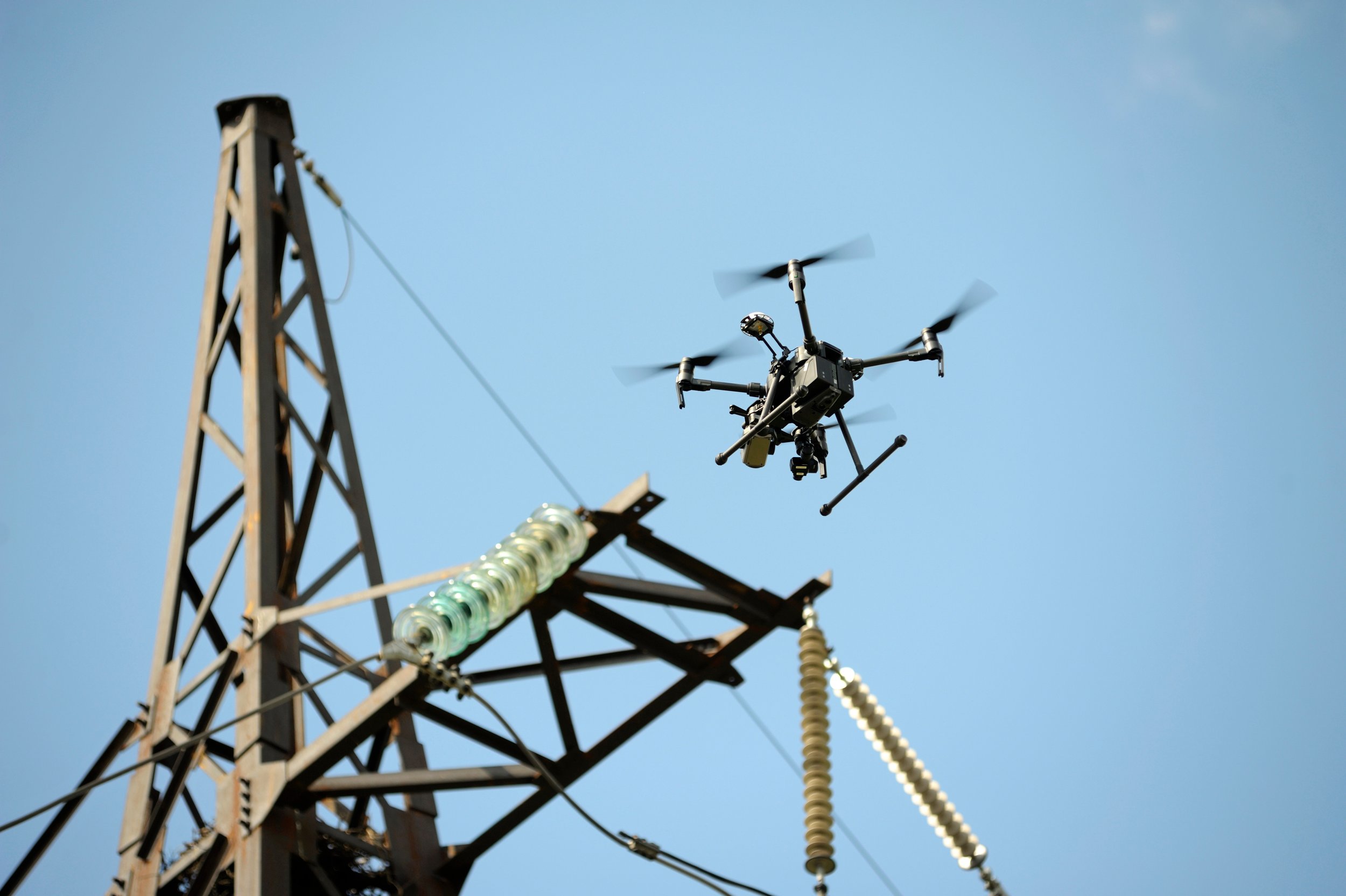
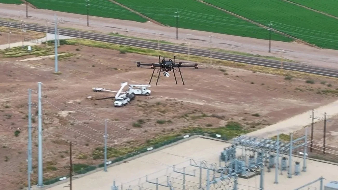
The Harris Aerial HX8 is a heavy-lift, industrial UAS platform operated by Cadence Aerial for advanced LiDAR and sensor-based data collection. Fully NDAA-compliant, it is well suited for critical infrastructure and government projects, providing the stability and payload capacity required for precise, repeatable operations and reliable geospatial deliverables supported by our in-house processing and quality control.
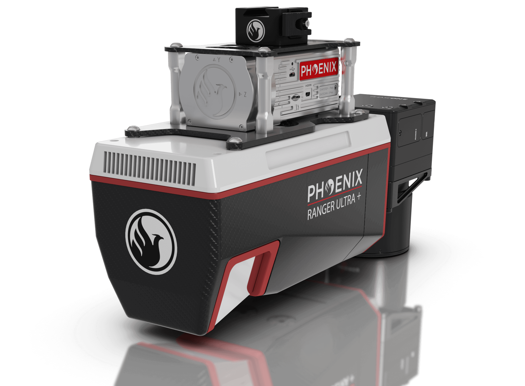

PHOENIX LIDAR SYSTEMS
AUSTIN, TX
Cadence Aerial operates a range of Phoenix LiDAR sensors, including the Ranger U-120 and Recon XT, to support projects of varying scale, terrain, and accuracy requirements. The U-120 is fully NDAA-compliant, government-related work and critical infrastructure projects, while our broader sensor lineup allows us to tailor acquisitions to each project’s technical and regulatory needs, from collection through final deliverables.
FAQs
-
Cadence Aerial is built on decades of combined experience in civil engineering, land surveying, construction, and professional inspections, supported by a strong understanding of FAA-regulated aviation. This background shapes how we collect, process, and deliver data—prioritizing accuracy, safety, and practical usability over novelty.
-
Yes. We support engineering and surveying teams by providing well-documented, georeferenced datasets that integrate cleanly with CAD and GIS workflows. Data is aligned to existing ground control and independently evaluated using control points and randomly distributed check points, with accuracy documented through transparent validation metrics. We’ve worked alongside both local and national firms and focus on clear communication and dependable support for licensed professionals.
-
Cadence Aerial is based in the Austin, Texas metropolitan area and regularly supports projects throughout the state of Texas. Depending on project scope and requirements, we also provide services across the south-central United States for infrastructure, energy, construction, and public-sector clients.
Because our operations are aviation-based and self-contained, service area is driven more by project needs than fixed geography. Specific locations and logistics are discussed during scoping to ensure alignment with timelines, access, and regulatory considerations.
-
Yes. Cadence Aerial has the capability to provide fully NDAA-compliant data acquisition using U.S.-manufactured and approved aircraft and sensor systems, supporting projects involving critical infrastructure, utilities, and government agencies.
-
We support construction, utilities, energy, land development, engineering, surveying, public safety, and critical infrastructure sectors.
-
Our team includes a full-time commercial pilot (CFI, II) and full-time FAA Part 107 UAS pilots, allowing us to provide reliable service without relying on subcontracted flight crews or introducing unnecessary operational variables.
-
Turnaround time depends on project size, data density, and deliverable requirements. At a minimum, we allow 2 days after acquisition to support quality GNSS processing. Depending on scope and deliverable expectations, most projects are typically delivered within one week.
Because all processing is performed in-house, schedules are predictable and discussed during scoping to ensure alignment with project needs. -
Accuracy is influenced by flight planning, conditions, and data processing—not just the sensor itself. Our data is aligned to ground control and independently checked using separate reference points, with results documented in an accuracy report.
Under suitable conditions, projects commonly demonstrate sub-tenth of a USFT vertical accuracy, as indicated by RMSEz results.
-
We inspect and document a wide range of assets including rooftops, transmission and distribution infrastructure, pipelines, substations, solar and wind energy facilities, construction sites, and transportation corridors. Our approach is guided by decades of experience in engineering and certified commercial/ residential inspections, guiding how we plan, capture data, and focus on the conditions that matter most.