
critical
infrastructure
CORE FEATURES:
NDAA Compliant LiDAR and Imagery Mapping
Asset Inspection and Documentation
Site and Construction Progress Monitoring
Thermal Imaging
Post-Storm Assessment
Explore more details about our infrastructure services below.

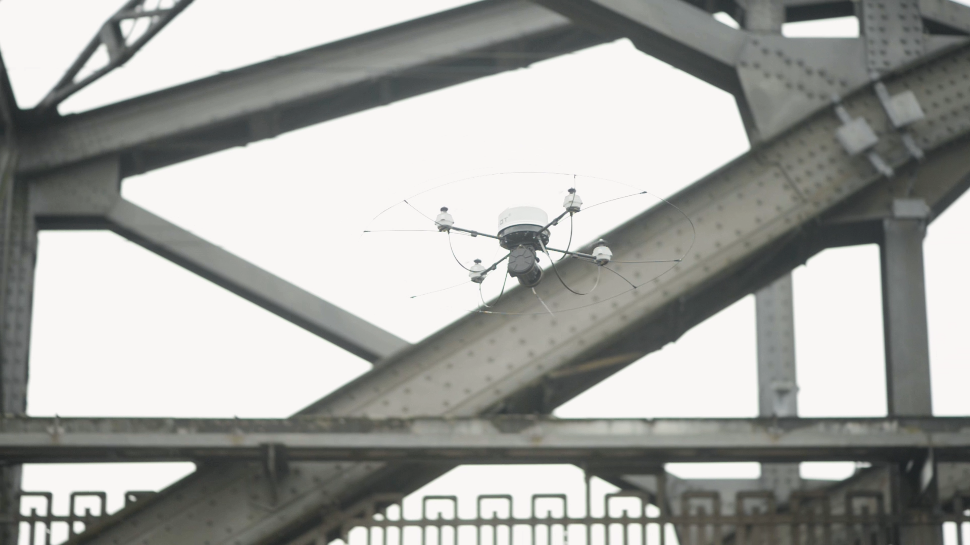
Main cable drone inspection, providing detailed visuals to assess structural integrity. This aerial perspective enables efficient, safe monitoring of critical bridge components.
-
Cadence Aerial provides fully NDAA-compliant mapping and data acquisition for projects involving critical infrastructure, government agencies, and regulated environments. We operate U.S.-manufactured and approved aircraft and sensor systems that meet National Defense Authorization Act (NDAA) requirements, enabling compliant LiDAR and imagery collection where foreign-manufactured equipment is restricted or prohibited.
NDAA-compliant acquisition is paired with secure, in-house data processing, ensuring sensitive datasets remain under direct control from collection through final delivery. By maintaining local data management, controlled workflows, and internal quality oversight, Cadence Aerial supports projects that require elevated standards for compliance, data integrity, and operational security while delivering reliable geospatial products for engineering, utility, and infrastructure applications.
-
Inspection and documentation of critical infrastructure require accuracy, consistency, and clear spatial context. Cadence Aerial uses drone-based inspection methods to document the condition of assets such as power transmission and distribution systems, substations, pipelines, bridges, transportation corridors, and energy facilities. High-resolution visual, thermal, and LiDAR data are collected to capture asset condition, geometry, and surrounding context while minimizing operational disruption and reducing the need for direct physical access.
Inspection results are delivered through an interactive, web-based reporting system that allows imagery and observations to be reviewed directly on a map with associated coordinates and asset identifiers. This format supports efficient remote review, collaboration, and long-term documentation by providing a consistent, georeferenced record that can be revisited over time. The reporting structure integrates smoothly with engineering, utility, and asset management workflows, supporting informed decision-making and ongoing infrastructure oversight.
-
Project and construction monitoring provides a consistent, objective record of site activity and infrastructure development over time. Cadence Aerial uses drone-based data collection to document construction progress, staging, access conditions, and installed features across active project sites, including complex or restricted environments. Repeatable capture methods allow changes to be tracked accurately from one reporting interval to the next while minimizing disruption to ongoing operations.
Monitoring deliverables are provided through an interactive, web-based reporting system and may also include georeferenced imagery, orthomosaics, and two-dimensional and three-dimensional mapping products. These outputs support remote review by project managers, engineers, and stakeholders, enabling clear visibility into construction status, coordination between teams, and long-term documentation of project evolution from early work through completion.
-
Thermal imaging provides a valuable tool for identifying temperature variations across critical infrastructure that may indicate abnormal operating conditions or developing issues. Cadence Aerial uses drone-based thermal sensors to inspect assets such as electrical transmission and distribution systems, substations, energy facilities, and other infrastructure where heat patterns can reveal performance concerns not visible through standard visual inspections.
Thermal data is captured in a georeferenced format and paired with visual imagery to provide clear context for each observation. These datasets support condition assessment, maintenance planning, and long-term documentation by allowing assets to be reviewed remotely and compared over time. Drone-based thermal inspections reduce the need for direct access to energized or hard-to-reach assets while supporting safe, efficient monitoring of critical infrastructure systems.
-
Post-disaster assessment and documentation provide rapid visibility into site conditions following events such as storms, flooding, wildfires, or other incidents impacting infrastructure and the built environment. Cadence Aerial uses drone-based visual and thermal imaging to safely capture detailed conditions across affected areas, allowing damage, access limitations, and visible impacts to be documented without placing personnel in hazardous or unstable environments.
Our fleet includes UAS platforms designed to operate in adverse weather conditions, including light rain, enabling near-immediate response when conditions permit. Imagery deliverables may include georeferenced photo sets, interactive reports, and orthomosaic GeoTIFFs that provide a consistent, map-accurate view of impacted areas. These datasets support remote review, coordination with response teams, and clear documentation that can be referenced throughout recovery and repair efforts.
Aerial progress image captured via drone at the new airport in NSW, Australia. Whether your project is large or small, UAS technology offers unmatched efficiency and visibility for remote management teams and stakeholders. Take advantage of real-time aerial views to enhance project monitoring and decision-making.

With the latest technology in the LiDAR space, bathymetric sensors allow us to penetrate below the surface of the water to capture ground surface models, as well as astonishing details of the primary structure.